There are lots of lovely walks in our area.
The Fife Coastal Path is rightly very popular. Are you aware that there are also lots of lovely local countryside routes? Some of these are old lanes but many are just earth paths like the one over the Binn. They can become overgrown in the summer but a small number of local volunteers do their best to cut back the foliage to keep all the paths open. Please enjoy them responsibly and consider avoiding wearing shorts to reduce the risk of picking up ticks. See below for more details.
Craigencalt Rural Community Trust (CRCT) is based near Kinghorn Loch. It has a Wednesday Walking Group with guided walks twice a month in summer, and once a month in winter. These are all local walks and the pace is usually relaxed. https://www.craigencalttrust.org.uk/fun-exercise
CRCT also has downloadable routes on its website as ‘Paths booklets’. Many start in Kinghorn but several include Burntisland and a little further afield e.g. Aberdour, Kirkcaldy, Auchtertool, Dalgety Bay. See the link to the Craigencalt Trust website below.
Path upgrade: This year, RioTintoAlcan (the landowner) upgraded the old millenium cycleway track east of the main east Binn access path to the Whinnyhall path. It's an easier walk than the main east Binn path but still a bit steep and bumpy for pushchairs, bikes and wheelchairs.
Fife Council also provides routes of Core Paths on its website and this includes the Burntisland area. See the link below to the Fife Council Core Paths and Access team.
Burntisland has a lovely situation on the sunny south coast of Fife - the ‘Fife Riviera’! We have our green hills of the Binn and Dunearn to protect us from north winds, a safe sandy beach and shallow bay backed by an accessible promenade, our ancient Links surrounded by our town centre conservation area, and countryside paths and old lanes through mixed woodland and farmland. Please enjoy getting out to enjoy our local area and help keep it safe and attractive for everyone.
A summary of our various local paths, tracks and routes follows below: Accessible paths (fairly level surfaced routes suitable to most users including wheelchairs), Coastal paths, Woodland paths, Hill paths, and paths further afield in the local area. See below.
Burntisland and its local area has a variety of different paths:
Accessible paths:
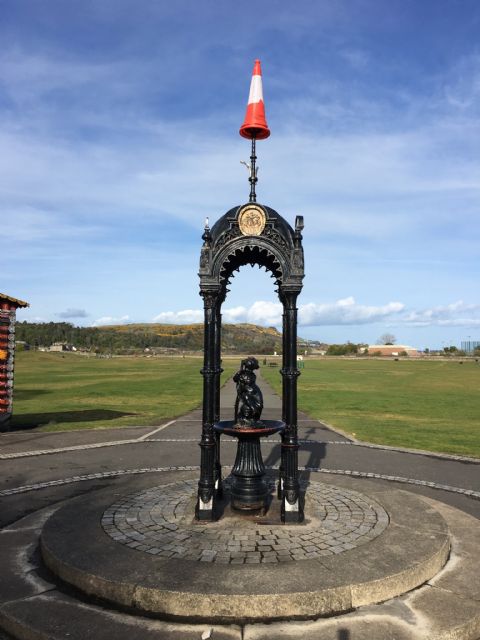
The Links paths and Beach Promenade are accessible to almost everyone. The central town area including the Links is a Conservation Area with much historical interest. The High Street has several tempting cafes and thriving shops. There is also seating on the Prom, the Links, and in the High Street area.
Beach and prom access: There are four pedestrian access 'tunnels' under the railway: 1. Near the west Links car park, skate park, MUGA pitches and leisure centre. 2. In the middle of the Links by the kiosks: steps only here but access is direct. 3. By the east Links play parks: This is a direct and step free access and suitable for wheelers 4. At the foot of Lochies Road (by the Sands Hotel): this is step free and suitable for bikes and wheelers. Only authorised motor vehicles are permitted on the Links and beach promenade! Cyclists and wheelers, please 'share with care'.
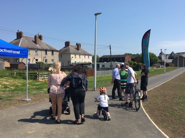
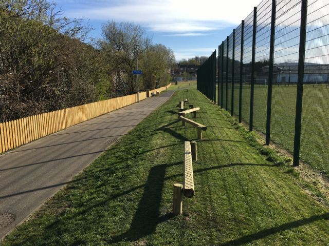
Active Travel Route (ATR) Meadowfield and Toll Park: The Toll Park is a small park on the north side of town beside the local Primary School, playing fields and Community Centre. It has accessible paved paths and some seating at the north east end. Meadowfield paths: Fife Council upgraded the path between Cowdenbeath Rd A909 and Glebe Place and constructed a new path to join the existing path from Kerr Court. Combined with the Toll Park Paths, these paths form a level off road route linking the Kirkton and Greenmount areas of Burntisland and ideal as a walk/cycle/scoot route to and from school, with a crossing patrol at the pedestrian crossing on Cowdenbeath Rd. The Meadowfield and Toll Park paths also benefit from street lighting.
Active Travel (ATR) to Kinghorn is fully accessible. This consists of: A shared pedestrian/roller/bike path from the east dock gates at Lammerlaws Rd, past the Beacon leisure CEntre, under the railway and across the Links, by quiet roads to Duncanson Drive park then alongside the A921. The route is signed. There are plans to continue it through the port area to Forth Place and the railway station. This forms an alternative coastal route to the Fife Coastal Path for bikes avoiding the beach promenade, which can be busy with pedestrians and those enjoying the beach.
Fife Coastal Path towards Aberdour between Kirkton Road and Colinswell House is accessible and pleasant, but becomes narrow, uneven, and undulating near the tunnel under the railway at the old Seamill tidal pond. Beware of bikes!
Coastal paths:
The Fife Coastal Path (FCP) passes through the town between Aberdour and Kinghorn. It is possible to walk along the shore between Burntisland and Kinghorn at low tide.
Burntisland Bay is part of the Forth Estuary SSSI. Sea birds and waders feed on the sands towards the Black Rocks and around the shore - please try not to disturb them, especially if dog walking.
If walking the FCP shore route to Kinghorn and there is a strip of sand between the rocks and the sea at the steps at the foot of Lochies Rd, unless you are a very slow walker, you should have no problems following the shore route.
If walking the FCP shore route from Kinghorn to Burntisland, if the tide is approaching high tide, you can find that it’s not possible to continue the shore route beyond the sand dunes. If this happens, retrace your steps to Pettycur and take the track from the beach to the path between Sandhills chalet park and the railway to access the pavement route via the railway bridge. NEVER attempt to walk over the railway - this is very dangerous and illegal. When the sea covers the sand at the foot of the cliffs below the Sandhills chalet park, the rough path over the rocks at the foot of the cliffs will still be clear - it should be quite obvious but is not suitable for walkers unused to rough tracks. Sandhills Chalet Park is private and there is no public access to it from either side of the headland.
The walk out to the Black Rocks along the sand bar is easier from Pettycur. Do watch the tide! If you want to keep your feet dry, waterproof footwear is essential.
Fit walkers only: The track from Seaside Cottages at the old Lochies pier, Burntisland, along the top of the seawall may look enticing at high tide but is not advised: It's rough with holes and trip hazards and has no easy exit by the railway tunnel opposite the cemetery where the descent is over boulders and loose railway clinker. It was damaged by Storms Babet and Ciaran and repairs make the track difficult and irregular.
The Lammerlaws is the rocky peninsula behind the Beacon Leisure Centre. It is part of the Forth Estuary SSSI. The marine coastal cliff vegetation here is vulnerable. Please do not light fires here and dispose of all litter, including dog poo, safely. The paths here are rough and a fall could be dangerous.
Ross Point is a similar peninsula to the west of the Castle and, although not part of the SSSI, the same cautions apply. Ross Point can be accessed either via the 'Monks' Walk' path west of the Castle off Rossend Terrace, or via the 'Red Pond' grassy amenity area from Haugh Road or the footpath by the old Seamill Pond via the tunnel under the railway off the Fife Coastal Path.
Woodland paths:
There are woodland paths at the Dells Wood between Kirkbank Road and the B923 near the Golf Club; on the Binn (our local hill); and the Heughs 'Bluebell Wood' between Aberdour and Burntisland. The Heughs Wood is signed from the FCP towards Aberdour up 70 steep and irregular wood and earth steps - for fit and agile walkers only! A little further afield, there are woodland walks at Beveridge Park, Kirkcaldy; Raith woods, Kirkcaldy; and Humbie Wood, Aberdour. Binn wood (south face of the hill) and Dunearn wood (north face) have no easy tracks and are steep - best left to the local wildlife!
Hill paths:
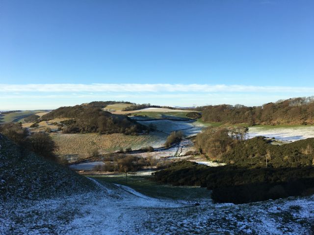
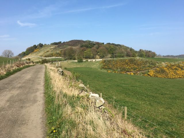
A traverse of the Binn summit (632ft) gives fantastic world class views in all directions. Paths are mostly unmade earth and may be slippy in wet weather. The main east and west traverse paths have steep sections and stiles. Take great care crossing any roads! There may be cattle in the meadow west of the summit.
Dunearn is the Binn’s sister hill and also has wonderful views from the summit. It has a tiny loch near the summit and the remains of an Iron Age fort which is a scheduled ancient monument in the care of Historic Scotland. The track to Dunearn summit can be reached from the sheep meadow to the east of Dunearn Farm, off the unclassified Standing Stane / Jawbanes Rd via a double field gate. Please follow the Countryside Code, keep all dogs on leads and leave all gates as you find them.
Access paths for the Binn are: (1) on the east opposite the Golf Club House off the B923 (Kinghorn Loch road) (2) on the west opposite the old Grange Distillery ruin off the A909 (Cowdenbeath road). Both these paths (1) & (2) can be linked up via the surfaced path through the Toll Park. There are other Binn access paths: (3) from the east opposite the Grangehill lane, near Craigencalt and Kinghorn Loch, passing Whinnyhall (4) from east via the Rodanbraes path, from Craigencalt lane near Kinghorn Loch (5) from the north from the unclassified 'Jaw Banes'/'Standing Stanes' road via the lane opposite Longloch Farm, past the ruins of 'the Common' (6) from the north from the unclassified 'Jaw Banes'/'Standing Stanes' road via the lane to the Binn mast (7) from the north from the unclassified 'Jaw Banes'/'Standing Stanes' road via an often muddy Right of Way track through fields and a wood (the Gale Slap) and an old lane by the Binn pond (8) from the west via a track by Kirsten Bell wood alongside the old Grange quarry off the A909 - this can be reached by steps and a track from the Fife Coastal Path (FCP) beside Colinswell House, via Kilmundy Hill (9) from the west from opposite the old Grange Farm up an old lane to the right of the derelict buildings in the old Grange quarry that leads to the meadow crossed towards the Binn Pond as in (2). The least steep way is by (9) and then take the track up towards the mast at Craigkelly and instead of turning up hill at the signpost, carry on further then take a track upwards to the right to reach the same point as the usual route from the west. There are cattle in the pasture on the west side of the Binn most of the year - take care, all dogs on leads, and never walk between a cow and calf. There are two half-moon gates on the west side, and a wooden stile on route (2), and stone steps over a wall on the east side.
Further afield:
There are quiet roads and lanes which link Burntisland with Aberdour, Kinghorn, and Auchtertool so circular walks of various lengths are easily planned. If walking on a road, it's best to walk on the side facing the on-coming traffic and be ready to step onto the verge if traffic approaches.
Kilmundy & Glassliehead: The paths between the Fife Coastal Path at Colinswell House, Kilmundy Hill, through the gorse under Glassliehead, and the Standing Stane Road at 'the Juck' provide a good link between coast and countryside paths. These are not Core Paths and are rough with stepped sections. They provide access towards Dunearn, and routes north to Stenhouse old reservoir, the old 'Great North Road' route to Cullaloe Hills, and west to Dalachy lane towards 'Kemal's Cut' to Aberdour.
Why not consider using the bus or train to facilitate one-way walks? From Dalgety Bay station a walk over wooded Letham Hill leads to the Fife Coastal Path and a pleasant walk back to Burntisland. Or, in the other direction, walks taking in Kirkcaldy, Dysart, West Wemyss, Thornton etc. are all possible.
Check out the local Core Paths maps via the links above and below to plan your routes.
Categories of 'path':
Paths in and around Burntisland fall into five main types:
1. Footways, pavements and surfaced paths around the town are the responsibility of Fife Council. If you have any issues with these, please contact Fife Council directly. (https://www.fife.gov.uk)
2. The Fife Coastal Path: Fife Coast and Countryside Trust (FCCT) maintain the Fife Coastal Path (FCP) which runs through Burntisland, including along the beach promenade. As a Core Path, this is a route shared between walkers, cyclists etc. so take care and be considerate to other users
3. Core Paths: The Land Reform (Scotland) Act 2003 sets out Statutory Access Rights and is often referred to as Scotland’s “Right to Roam” legislation. As part of this legislation, local authorities, e.g. Fife Council, had to identify Core Paths in their area. (See the link to Local Core Paths.) Many, but not all, of the Core Paths are also Rights of Way.
Unfortunately, the legislation does not set out any statutory obligations on either landowners or local authorities to maintain these Core Paths. So, as it’s nobody’s responsibility to maintain them, generally nobody does it. Identifying resources and funding to help can also be difficult. Locally, nearly all maintenance is done by volunteers.
There are other countryside routes which are not Core Paths:
4. Rights of Way: Scotways (a charity) keeps a register of routes which are Rights of Way (RoW) but charges for releasing this information. A RoW may or may not be visible on the ground as an actual path. If you have any queries about a RoW, please contact the Fife Council Access Team: https://www.fife.gov.uk/kb/docs/articles/community-life2/parks,-allotments,-core-paths/outdoor-access
5. Permitted Access Paths which are not Rights of Way, but where the landowner permits access. Responsible access rights apply - see the Outdoor Access Code: https://www.outdooraccess-scotland.scot/
Enjoy getting out & active!
Anne Smith
You can contact me about any paths issues using the 'contact us' facility on this website home page.
Useful websites:
Local Core Paths interactive map:
Core Paths Burntisland and Kinghorn:
Core Paths Burntisland and Aberdour:
Rights and responsibilities for path users: https://www.outdooraccess-scotland.scot/
For information on Rights of Way contact ScotWays: https://www.scotways.com/
Fife Coast and Countryside Trust: https://fifecoastandcountrysidetrust.co.uk/
Craigencalt Rural Community Trust (Kinghorn) have a walking group: http://www.craigencalttrust.org.uk/
All you need to know about ticks in the countryside:
https://www.nhsinform.scot/illnesses-and-conditions/infections-and-poisoning/lyme-disease
There are lots of local walking groups of different types. Some groups are just informal groups of pals who meet regularly to walk locally, or further afield. Some groups are more formal clubs that may welcome new members.
Ramblers Scotland has several affiliated local walking groups:
https://www.ramblers.org.uk/scotland.aspx
